
Caribbean Road Networks
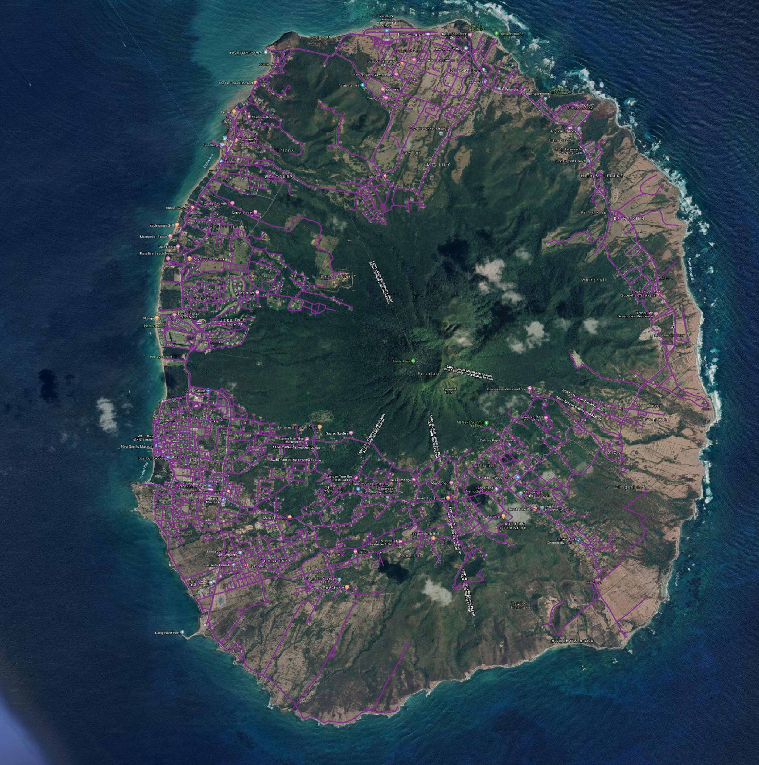
Nevis Road Network 2019

Charlestown Nevis Road Network 2019
VerticalGeo spent time this past summer creating road networks for most of the islands in the Caribbean. The screenshots below came from our St Kitts and Nevis Road Network Update Map. You can view our work there on the simple webmap we have posted online. Every year the islands in the Caribbean get slammed with hurricanes and need humanitarian aid to help overcome the disaster. The people of the Caribbean are very resourceful and resilient, and we decided that we could help them by providing updated road network maps. We started with satellite imagery and began with Open Street Map files of the entire Caribbean. We then took these Open Street Map files and used them to show us where the existing road networks were at. When we came across Open Street Map files that weren't accurate we updated them. When we came across areas where we saw road networks on the satellite imagery, but no roads documented in Open Street Map, we added the roads. When we came across roads documented in Open Street Map that we did not find on satellite imagery we deleted them from our Open Street Map files. In the screenshot below the purple roads are the road network we created for the country of Nevis. Here is a close up of the road network of the town of Charlestown in Nevis. We have completed road network mapping for the following countries:
Anguilla
Antigua
Barbados
Barbuda
Bolivia
British Virgin Islands
Cayman Islands
Colombia
Cuba
Dominica
Ecuador
French Guiana
Grenada
Guyana
Malawi
Mozambique
Paraguay
Saint Barthelemy
Saint Martin
St Kitts and Nevis
St Lucia
St Vincent and the Grenadines
Trinidad and Tobago
US Virgin Islands
We see this as an opportunity to help out the international disaster relief organizations that need data like this to help plan relief efforts around the world.
Georeferencing Imagery in ArcGIS 10.1 Desktop Tutorial
We have had a lot of people lately ask us how to georeference imagery. So, as long as it is a hot topic, we just posted VerticalGeo's new video tutorial on "Georeferencing Imagery in ArcGIS 10.1 Desktop" on our YouTube Channel. Here it is:http://youtu.be/cAPykiB2YyA
Blaise Agüera y Arcas: Augmented-Reality Maps
One more TED post from Blaise Aguera y Arcas on the Augmented Reality Maps work he did while with Microsoft Bing Maps. This application shows a great integration of imagery and mapping.
Dan Berkenstock: The world is one big dataset. Now, how to photograph it ...
Great TED video of Dan Berkenstock talking about the vision of SkyBox and what drives them. This is "game changing" technology that will force the mapping industry to evolve and produce more dynamic and increasingly important capabilities. I am very excited with what SkyBox and the other small satellite companies are doing.