Cleaning LiDAR Tiles: Tug and Barge
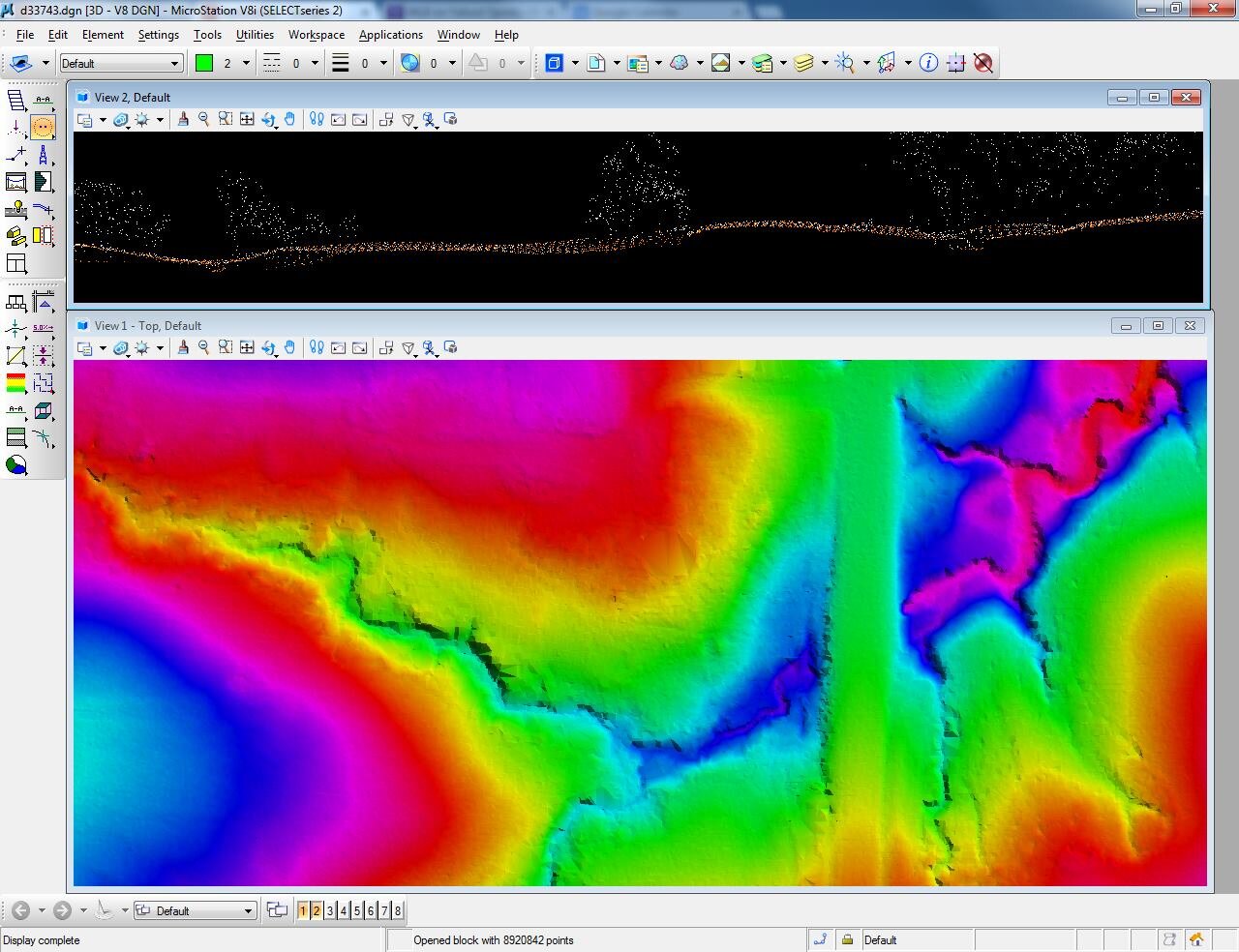
Cleaning more LiDAR tiles today. This one includes a Tug and Barge combination that I found in the middle of the Mississippi River near New Madrid, Missouri. No one will ever know it was there when I get done with the tile. The top view is a cross section elevation and shows what the elevations look like from the side. The bottom view is an overhead look at the Tug and Barge.
International Year of Light
Thanks to our friend Brittany K. L. Mabry for putting together a great article on the International Year of Light for LiDAR News. Expect to hear lots of information regarding the use of LiDAR and other light-based technology over the next year. Here is a link to the article:http://www.lidarnews.com/content/view/11124/136/
New LiDAR Project
Half way done tonight with our 5 week LiDAR classification/cleanup project for the Arkansas Department of Fish and Wildlife. The screenshot below is a 1 mile by 1 mile tile that includes over 8 million points. Airborne LiDAR uses an aircraft equipped with a laser scanner to image the earth's surface. It doesn't take color pictures, but takes a snapshot of the earth's elevation. So the below tile includes a creek running through a culvert under a road. The creek is the lowest elevation and is represented by a magenta color. The road is the highest elevation and is represented by a green color. I enjoy working with LiDAR and the tools you can produce from the data. It just takes forever to process, classify, and clean up.
Using Terrestrial LiDAR for Cultural Heritage Documentation
In July VerticalGeo hosted the ASPRS Heartland Region's monthly Technical Presentation. Brittany Mabry, a graduate student from the University of Arkansas' Center for Advanced Spatial Technologies (CAST), presented on "Using Terrestrial LiDAR for Cultural Heritage Documentation." It was a fascinating presentation that highlighted how Brittany, and the CAST team has used, and taught others to use, Terrestrial LiDAR to digitally capture 3-D imagery of cultural heritage resources around the globe. This is wonderful technology that will allow us to capture and preserve in 3-D those historic places that define our world. Here is Brittany's presentation:
How LiDAR is Revolutionizing Maps and Geospatial Data
Thanks to Art Borum of Kaskaskia College for pointing me to a great article by Patrick Marshall (no relation) titled How LiDAR is Revolutionizing Maps and Geospatial data. LiDAR (Light Detection and Ranging), which uses laser beam pulses to measurement of elevation, truly is a transforming technology.
City of O'Fallon, Illinois LiDAR
Here's a current article that describes what the City of O'Fallon is doing with the LiDAR data that we provided them earlier this year. Great work Chad Quinn and Dan Gentry.


