VerticalGeo creates, maintains, and integrates geospatial data for our customers
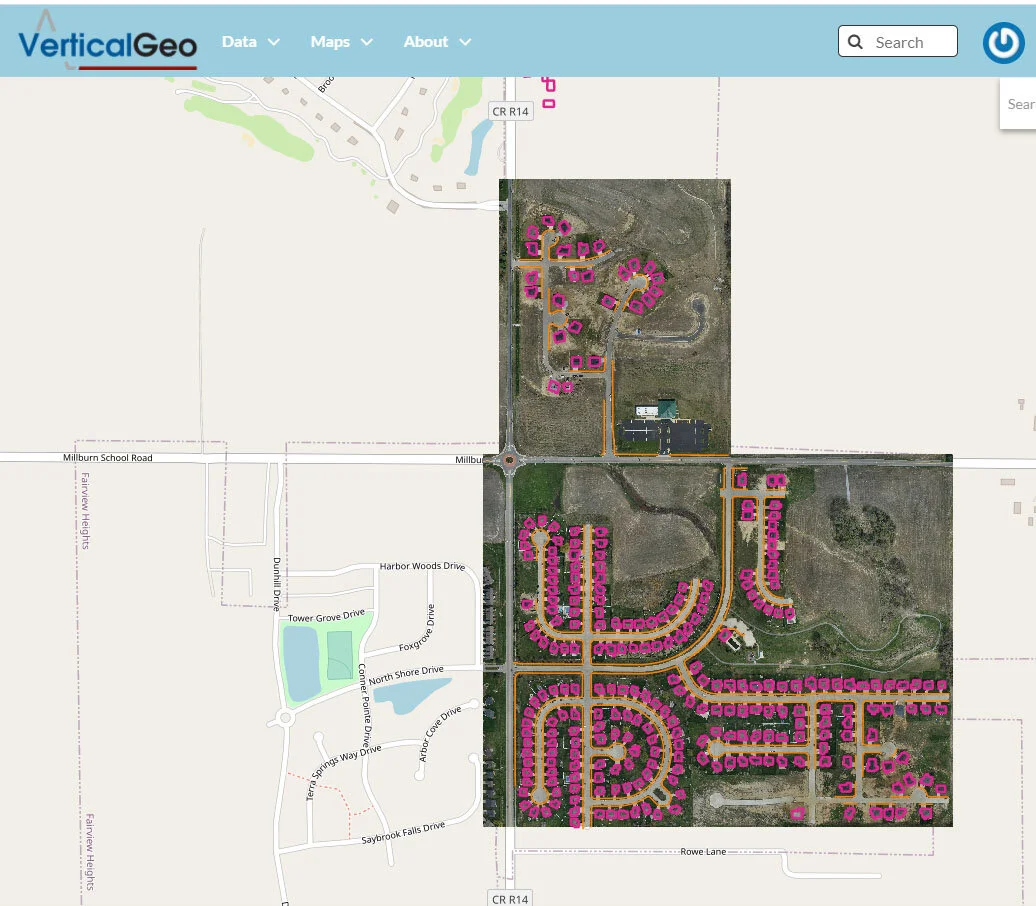
For many years VerticalGeo has been working with our home city, the City of O’Fallon, Illinois, to find the most cost effective way to deliver quality neighborhood data rapidly to the city planners. In March 2020 we started using our Black Swift Technologies S-1 drone with integrated RTK GPS correction to collect orthophotography of selected O’Fallon nieghborhoods from which we collected building footprint and sidewalk features to update the City of O’Fallon’s geodatabase. We were able to provide the aerial orthophotography and building footprint and sidewalk data for 7 separate rapidly growing neighborhoods within two weeks. Normally it takes several months for the city just to receive orthophotography. Two of the neighborhoods are highlighted in the below VerticalGeo Web Map. Click on the image below to go to the associated interactive web-map on the VerticalGeo Web Mapping site.