
Checking Ground Control at Carlyle Lake State Fish and Wildlife Area
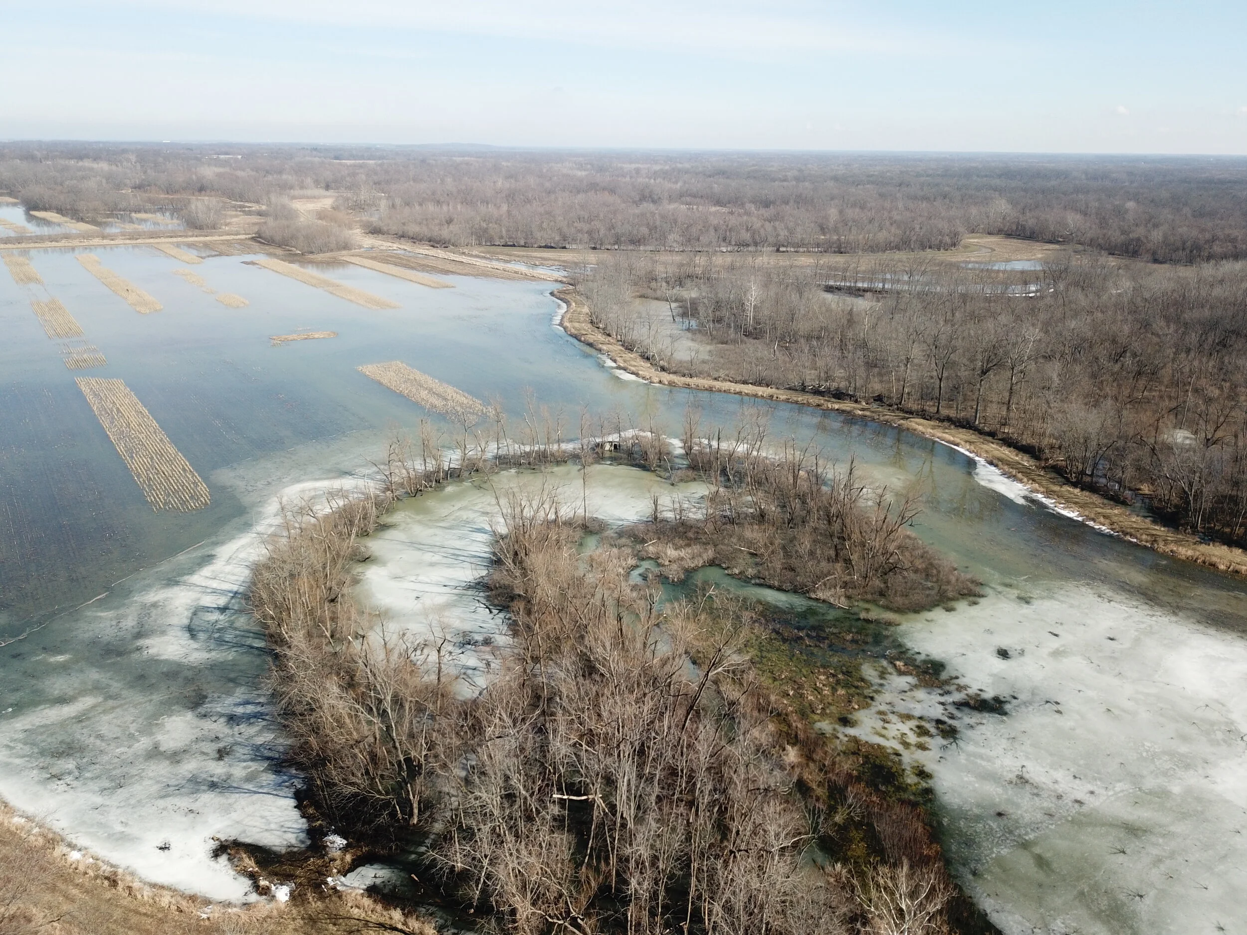
In an earlier post I shared some photos and insights into setting up Ground Control at Carlyle Lake for a LiDAR and Orthophoto collection flight for about a 40 square mile area. A Ground Control Survey, along with its associated targets, is what allows us to make sure the photos and LiDAR data we collect are aligned in the proper geographic location. We set up the Ground Control targets thinking we would fly the LiDAR and Orthophoto collection sometime in the following week, but we received so much snow and had such cold weather (25 straight days that never got above freezing) that we actually had to wait a month for the snow to melt and the water levels to lower back down to the winter pool level. That winter pool water level will allow us to collect LiDAR in most of the ditches and wetlands areas surrounded by levees. As you can see from the above photo, even a month later, after a week of 60 degree weather, there was still snow and ice in large portions of the wetland. Illinois can get very wet in March and April and every spring we run the risk of heavy flooding, so we had a break in the weather and a window of opportunity this week to fly the LiDAR and Orthophotos and we thought we needed to take advantage of the good weather.
After a month of snow and ice we decided to check the Ground Control targets to make sure they were still in good shape for the collection. After being covered with snow and in a few cases flooding water, we thought it would be a good idea to check every one of them. The problem is that the area has been so wet that we did not think we could get to some of the targets we had access to when we set them when the ground was frozen. We made the decision to do drive by checks for the targets on hard surfaced roads and parking lots and to take a series of 5 preplanned automonous flights with our Unmanned Aerial System (UAS, or drone). For this flight we used our 5 year old DJI Mavic Pro drone with the DJI Go 4 App coupled with mission planning software called DroneLink. We downloaded DroneLink, did a few test flights in the office parking lot and headed off to Carlyle Lake to take try to photograph the Ground Control targets and give us some reassurance that they were still usable.
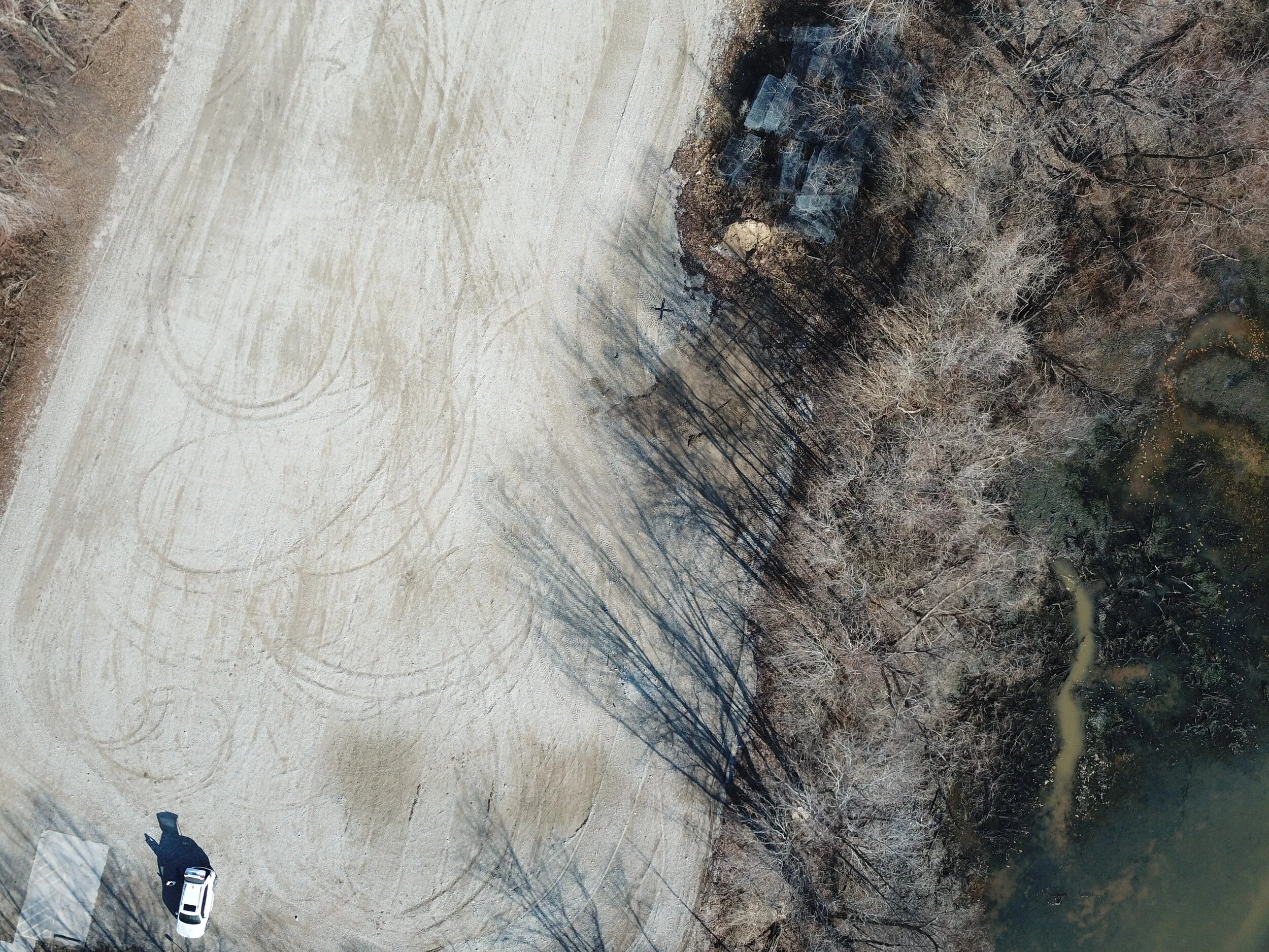
The Mavic Pro is old in drone technology years, but worked like a champ. It gave us the needed 20-30 minute flight duration for each of our photo missions. The above photo is one of the first photos we took before the autonomous mission as a test photo before going out on the mission. The Ground Control target is the black “X” in the upper center section of the photo. The Mavic took this photo from approximately 250 feet Above Ground Level. Most of our targets were white, but this one was against a light colored background, so we used a black target for this Control Point. All of these targets were surveyed with a better than 5 cm survey grade accuracy.
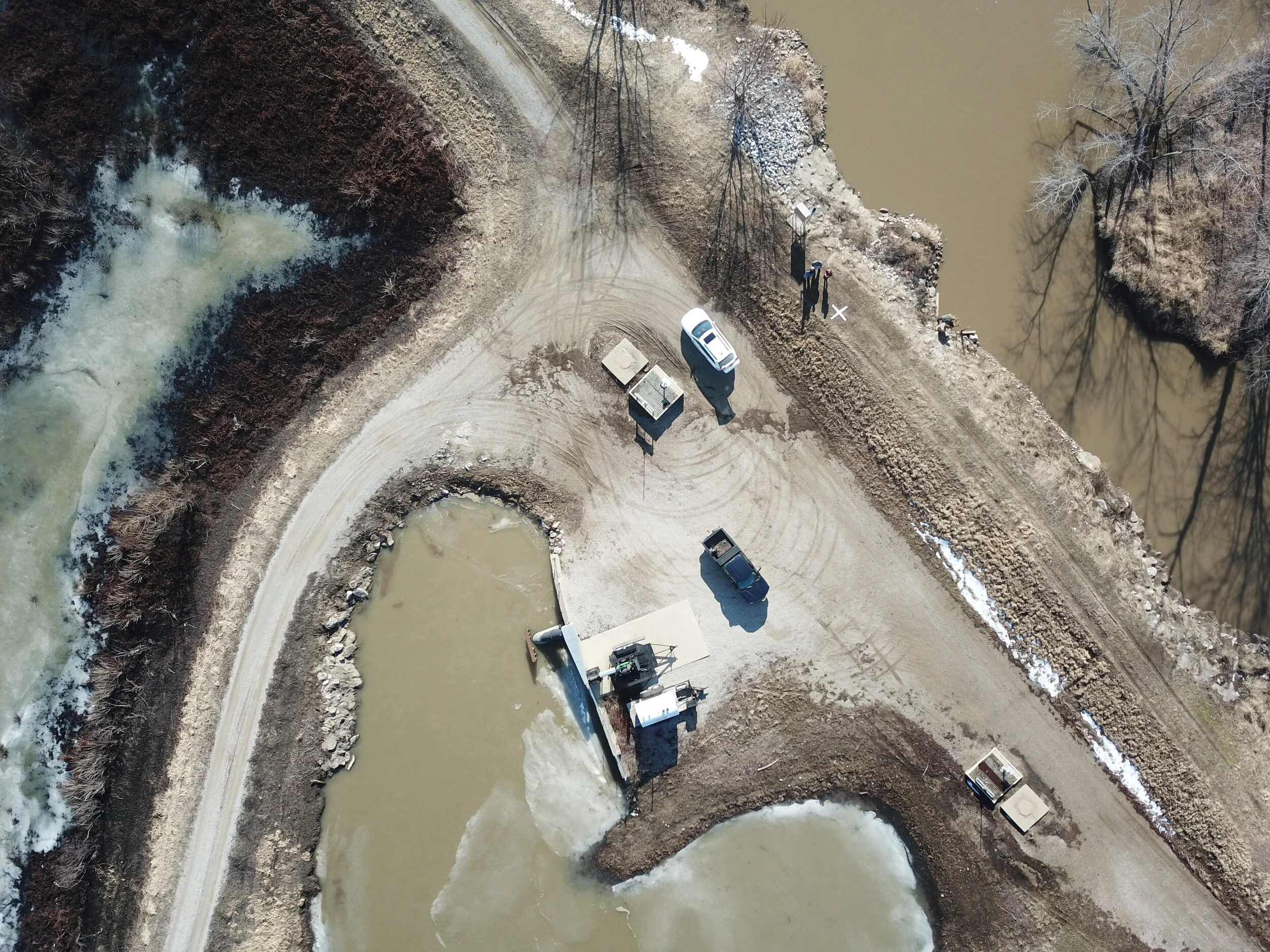
This is another target we could drive to. It is near a pumping station at the center of our wetlands project. You can see the white target on top of the levee in the upper center area of the photo. These two photos showed us what the Mavic could do and that we could use it to capture photos of targets that were inaccessible due to mud and ice.

The above is a photo of a target that wasn’t very accessible. You can faintly make out the white “X” near the center of the photo. We couldn’t get close enough to it on the ground to observe it, but the Mavic captured the photo and reassured us that the target was still there unharmed.

The above Ground Control target was in a very muddy area behind a locked gate. The Mavic picked it up well
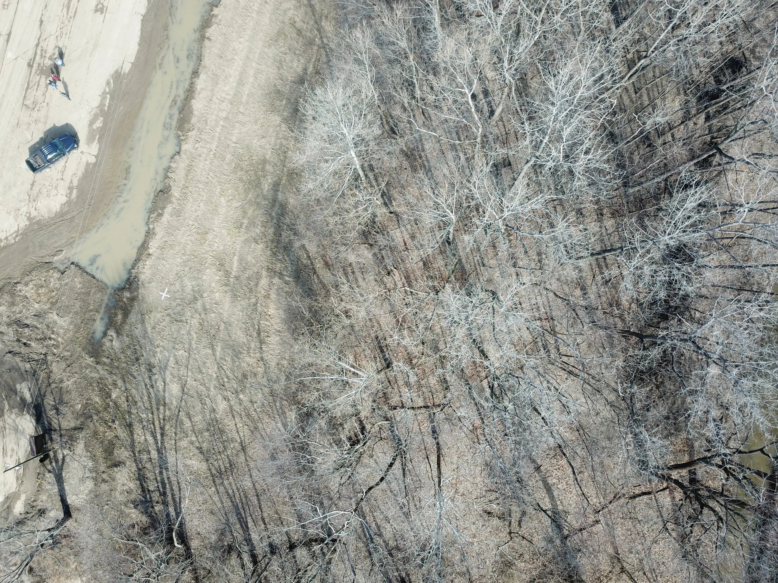
The above target, located in the left center section of the photo, is a good demonstration of how valuable the Mavic was. Until the day before we shot this photo the target was under water. We were only about 50 feet away from the target, but we could not get to it because the ground was so muddy. The truck is parked on a hard packed parking lot, but the rest of the area is inaccessible.

In this final example you can see the target just to the left of the levee intersection. This is a great photo to show the value of the UAS. We were only about 1/4 mile away, with the UAS in full visual contact, but the levee roads were too muddy to get any closer to the target. The UAS is the only way we could have checked on the condition of the target without either risking damage to our vehicle or ourselves. With the effort of a 5 minute round trip flight we were able to assess the condition of the target and assure ourselves that the targets we placed in this small area were still usable.
Out of the 40 Ground Control Survey targets we set up a month ago, we were only able to do a drive by check on about 10 of them. We were able to set up our UAS operations in areas where we could visually watch the UAS fly from target to target while we managed the flight and captured the photos. We were able to check on the condition of all 40 targets in about 5 hours. The UAS saved us an estimated 2 days of work slogging around in mud, ice, and water. It was well worth our time and effort.